Meandair API Specification (1.2.19)
Download OpenAPI specification:Download
Specification of available Meandair API end-points.
In general, the API provides PNG tiles of the visually rendered weather and a JSON representation of the weather at particular locations. The Weather Catalogue lists all the available weather values with additional information. Some of the weather values are available as tiles, some are available as JSON values, and some are provided in both forms.
The API requests require authentication first by the /api/v1/auth/jwt end-point, which generate a
JWT token, which is then used in all following requests to
authenticate the request. The token is sent as part of the request headers as a Bearer parameter. The default
duration of the JWT token is set to 31 days.
If it is not possible to use the Bearer token (e.g., in case of tile requests which allow parameterization only
by additional GET parameter as in Google Maps API), a session token can be generated by the api/v1/auth/session
end-point and later used in the following GET requests. The default duration of the session token is 3 hours.
The requests currently allow maximal size of 1MB in the POST data. For larger POST payloads, please split the data into smaller requests and send them sequentially.
The following example shows how the bearer and session tokens can be requested and used in following API calls.
$ curl -d '{"uid": "<username>", "passwd":"<password>"}' 'https://prod.meandair.com/api/v1/auth/jwt'
<bearer-token>

$ curl -H 'Authorization: Bearer <bearer-token>' 'https://prod.meandair.com/api/v1/aw-metars?latitudes=49.345634,51.1234&longitudes=23.53472,22.2345'
[{"elevation":{"unit":"m","value":285.9852294921875},"latitude":{"unit":"degree_north","value":49.345634}, ...]

$ curl -H 'Authorization: Bearer <bearer-token>' 'https://prod.meandair.com/api/v1/tiles/precipitation-composite/5_999_15_9_2024-01-05T17:10:00.000Z.png' | display

$ curl -d '{"uid": "<username>", "passwd":"<password>"}' 'https://prod.meandair.com/api/v1/auth/session'
<session-token>

$ curl 'https://prod.meandair.com/api/v1/tiles/precipitation-composite/5_999_15_9_2024-01-05T17:10:00.000Z.png?session=<session-token>' | display
The authentication should be done from your server, not from the clients/browsers (as in the browser your password would be in plain text and could leak).
When you have the session token (or the whole URL template with the session token as shown in code snippets), you can send it to your client/browser to be used to request the particular tile or other API endpoints.
JavaScript
async function authorize() {
    const sessionUrl = "https://prod.meandair.com/api/v1/auth/session";
    const username = "<username>";
    const password = "<password>";

    const payload = { uid: username, passwd: password };

    try {
        const response = await fetch(sessionUrl, {
            method: 'POST',
            headers: {
                'Content-Type': 'application/json'
            },
            body: JSON.stringify(payload)
        });

        if (response.status === 200) {
            const sessionToken = await response.text();
            console.log(`Example URL: https://prod.meandair.com/api/v1/tiles/{weather}/{zoom}_{altitude}_{col}_{row}_{datetime}.png?session=${sessionToken}`);
        } else {
            console.log(`Error requesting from URL ${sessionUrl}: ${response.status}`);
        }
    } catch (error) {
        console.error('Error making the request:', error);
    }
}

authorize();
Python
import requests

def authorize():
    session_url = "https://prod.meandair.com/api/v1/auth/session"
    username = "<username>"
    password = "<password>"

    payload = {'uid': username, 'passwd': password}

    # Making the POST request to get the auth token
    response = requests.post(session_url, json=payload)
    if response.status_code == 200:
        session_token = response.text
        print(f"Example URL: https://prod.meandair.com/api/v1/tiles/{{weather}}/{{zoom}}_{{altitude}}_{{col}}_{{row}}_{{datetime}}.png?session={session_token}")
    else:
        print(f'Error requesting from URL {session_url}: {response.status_code}')

authorize()
Weather type Identifier (deprecated identifier) | Description |
Units | Range | Supported altitude | Look- ahead | Refresh rate (down to) | Legend |
|---|---|---|---|---|---|---|
| Precipitation | ||||||
precipitation-probability (pc) | Precipitation probability |
||||||
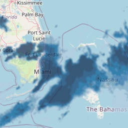 |
% | 0 - 100 | FL, Overview | 24h | 10mins | 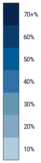 |
convective-precipitation-rate (crr) | Convective precipitation rate |
||||||
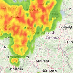 |
mm/h | 0 - 50+ | FL, Overview | 24h | 10mins | 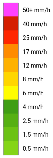 |
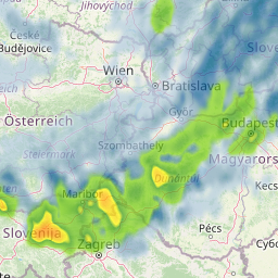
precipitation-composite (crr-pc) |
Precipitation composite (Precipitation probability, Convective precipitation rate) |
||||||
 |
%, mm/h | 0 - 100, 0 - 50+ | FL, Overview | 24h | 10mins | 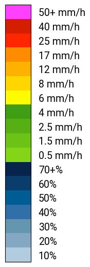 |
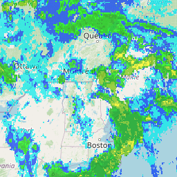
precipitation-rate (pc-amount) | Precipitation rate |
||||||
 |
mm/h | 0 - 50+ | Overview | 24h | 10mins | 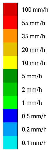 |
reflectivity | Radar reflectivityThis data product contains modified EUMETNET OPERA radar composite available via ORD API and used under CC-BY 4.0. |
||||||
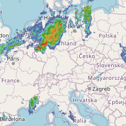 |
dBZ | 0 - 60+ | Overview | 5h | 10mins | 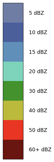 |
reflectivity-composite | Radar reflectivity with rain/snow palette selection from precipitation-type.
|
||||||
|
dBZ, class | 0 - 60+, 0 - 2 | Overview | 5h | 10mins | 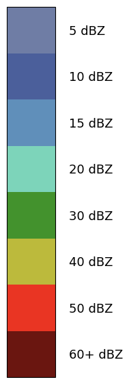 |
precipitation-type | Precipitation classification (no precipitation, rain, snow) |
||||||
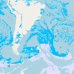 |
class | 0 - 2 | Overview | 24h | 1h | 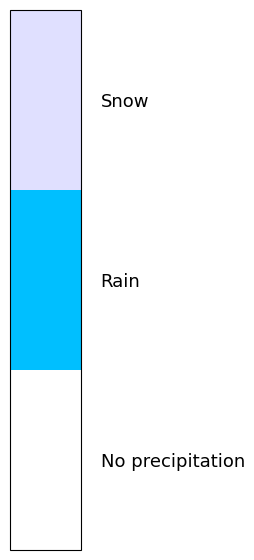 |
precipitation-arrival | Precipitation arrival time |
||||||
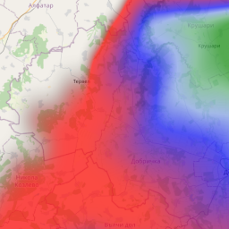 |
10 min | 0 - 36 | Overview | 5h | 10mins | 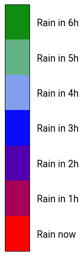 |
precipitation-arrival-binary | Precipitation presence in the next hours |
||||||
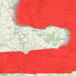 |
- | - | Overview | 5h | 10mins | 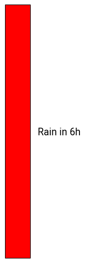 |
| Clouds | ||||||
cloud-cover | Cloud cover |
||||||
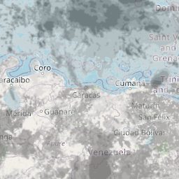 |
% | 0 - 100 | FL, Overview | 24h | 10mins | 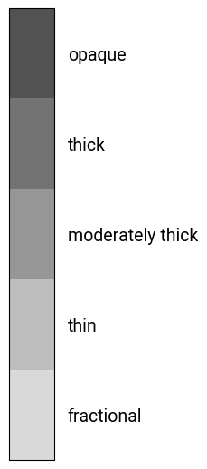 |
cloud-composite (clouds) | Cloud composite (Cloud cover, Cloud top relief) |
||||||
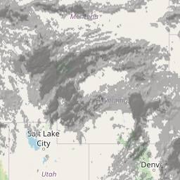 |
%, - | 0 - 100, - | Overview | 24h | 10mins | |
cloud-cover-error | Cloud cover error |
||||||
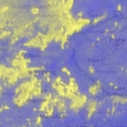 |
% | 0 - 100 | Overview | 24h | 10mins | 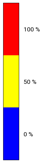 |
cloud-mask-error | Cloud mask error |
||||||
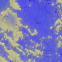 |
1 | 0 - 1 | Overview | 24h | 10mins | 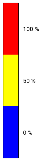 |
cloud-top-amsl (ctth-height) | Cloud top altitude (AMSL) |
||||||
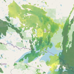 |
m | 0 - 15000+ | Overview | 24h | 10mins | 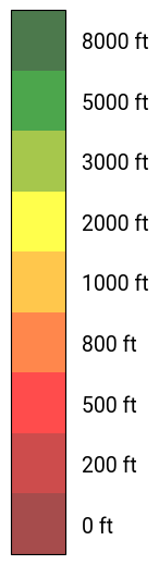 |
cloud-lowest-top-amsl (lowest-top) | Lowest cloud top altitude (AMSL) |
||||||
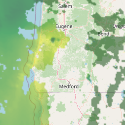 |
m | 0 - 15000+ | Overview | 5h | 5mins | 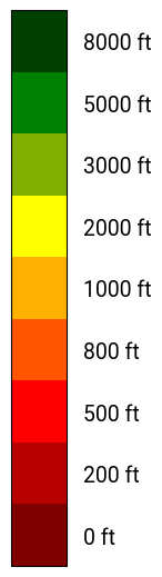 |
cloud-ceiling-agl (ceiling) | Cloud ceiling height (AGL) |
||||||
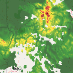 |
m | 0 - 15000+ | Overview | 24h | 5mins | 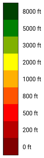 |
| Visibility | ||||||
visibility-sfc (surface-visibility) | Surface visibility |
||||||
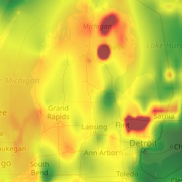 |
m | 0 - 30000+ | Overview | 24h | 10mins | 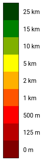 |
| Wind | ||||||
wind-composite-10m-agl (wind-10m-agl) |
Wind composite at 10m AGL (Wind speed at 10m AGL, Wind direction at 10m AGL) |
||||||
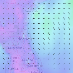 |
m/s, degT | 0 - 30+, 0 - 359 | Overview | 24h | 10mins | 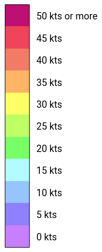 |
wind-gust-10m-agl | Wind gust at 10m AGL |
||||||
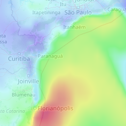 |
m/s | 0 - 50+ | Overview | 24h | 10mins | |
wind-composite-80m-agl |
Wind composite at 80m AGL (Wind speed at 80m AGL, Wind direction at 80m AGL) |
||||||
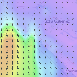 |
m/s, degT | 0 - 40+, 0 - 359 | Overview | 24h | 10mins | |
wind-composite | Wind composite (Wind speed, Wind direction) |
||||||
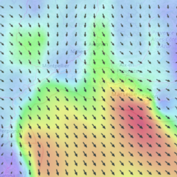 |
m/s, degT | 0 - 80+, 0 - 359 | FL | 24h | 10mins | |
| Severe weather | ||||||
turbulence-composite (turbulence) | Turbulence composite (Turbulence, Turbulence contour) |
||||||
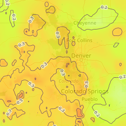 |
EDR, EDR | 0 - 1, 0 - 1 | FL, Overview | 24h | 10mins | 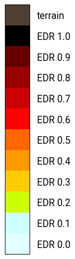 |
thunderstorm (thunderstorms) | Thunderstorm |
||||||
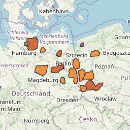 |
class | 1 - 5 | FL, Overview | 5h | 10mins | 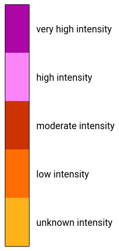 |
icing-severity | Icing severity |
||||||
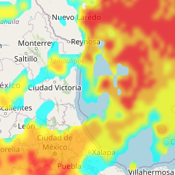 |
class | 0 - 4 | FL, Overview | 24h | 10mins | 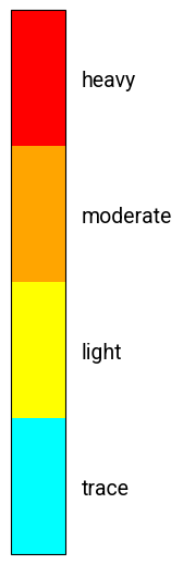 |
weather-type | Weather type |
||||||
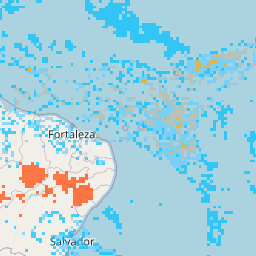 |
class | 0 - 26 | Overview | 24h | 10mins | 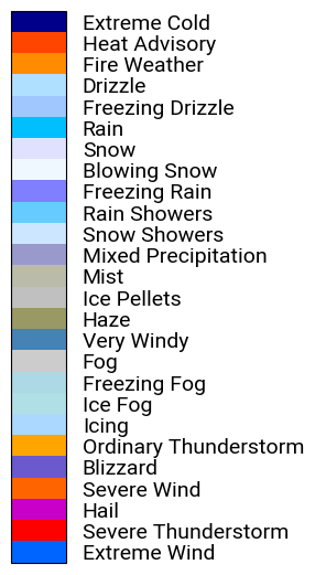 |
| Indices | ||||||
k-index | K-Index |
||||||
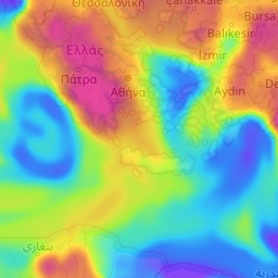 |
degC | -90 - 70+ | Overview | 24h | 10mins | 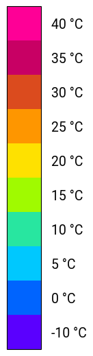 |
| Temperature | ||||||
air-temperature-2m-agl | Air temperature at 2m AGL |
||||||
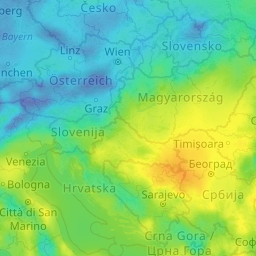 |
degC | -90 - 50+ | Overview | 24h | 10mins | 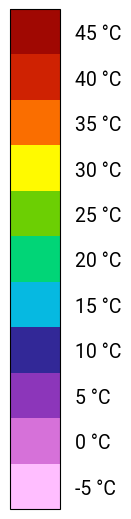 |
dew-point-temperature-2m-agl | Dew point temperature at 2m AGL |
||||||
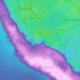 |
degC | -35 - 35+ | Overview | 24h | 10mins | |
| Pressure | ||||||
air-pressure-qnh | QNH pressure |
||||||
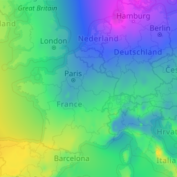 |
Pa | 87000 - 108000 | Overview | 24h | 10mins | 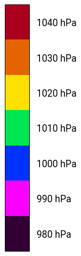 |
| Flight Rules | ||||||
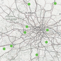
metar | METAR-based flight rules |
||||||
 |
class | LIFR, IFR, MVFR, VFR | Overview | 5h | 5mins | 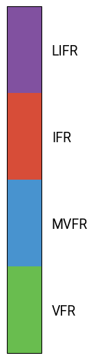 |
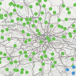
airport (airports) | Meandair AirportWeather-based flight rules |
||||||
 |
class | LIFR, IFR, MVFR, VFR | Overview | 5h | 5mins | |
| Solar | ||||||
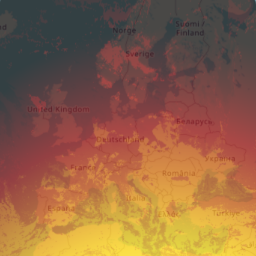
global-horizontal-irradiance | Global horizontal irradiance |
||||||
 |
W/m2 | 0 - 1000 | Overview | 5h | 10mins | 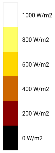 |
Refresh rate details
| Region | Refresh rate |
|---|---|
| Africa | 15mins |
| India | 15mins |
| rest of world | 10mins |
Thunderstorm class description (thunderstorm)
| Class | Description |
|---|---|
| 1 | Unknown |
| 2 | Low |
| 3 | Moderate |
| 4 | High |
| 5 | Very high |
Icing severity class description (icing-severity)
| Class | Description |
|---|---|
| 0 | None |
| 1 | Trace |
| 2 | Light |
| 3 | Moderate |
| 4 | Severe |
Weather type class description (weather-type)
| Class | Description |
|---|---|
| 0 | No significant weather |
| 1 | Extreme wind |
| 2 | Severe thunderstorm |
| 3 | Hail |
| 4 | Severe wind |
| 5 | Blizzard |
| 6 | Thunderstorm |
| 7 | Icing |
| 8 | Ice fog |
| 9 | Freezing fog |
| 10 | Fog |
| 11 | Very windy |
| 12 | Haze |
| 13 | Ice pellets |
| 14 | Mist |
| 15 | Mixed precipitation |
| 16 | Snow showers |
| 17 | Rain showers |
| 18 | Freezing rain |
| 19 | Blowing snow |
| 20 | Snow |
| 21 | Rain |
| 22 | Freezing drizzle |
| 23 | Drizzle |
| 24 | Fire weather |
| 25 | Heat advisory |
| 26 | Extreme cold |
Precipitation type class description (precipitation-type)
| Class | Description |
|---|---|
| 0 | No precipitation |
| 1 | Rain |
| 2 | Snow |
Flight rules class description (metar, airport)
| Icon | Colour | Flight rule | Description | Visibility | Cloud ceiling height (AGL) |
|---|---|---|---|---|---|
 |
Magenta | LIFR | Low Instrument Flight Rules | < 1.5 km | < 500 ft |
 |
Red | IFR | Instrument Flight Rules | 1.5 - 5 km | 500 - 1000 ft |
 |
Blue | MVFR | Marginal Visual Flight Rules | 5 - 8 km | 1000 - 3000 ft |
 |
Green | VFR | Visual Flight Rules | > 8 km | > 3000 ft |
Authenticate user and get JWT token.
Request a JWT token as a string that can be used for all other requests in a header "Bearer
Requires authentication by POSTing user id and password.
Request Body schema: application/jsonrequired
| uid required | string |
| passwd required | string |
Responses
Request samples
- Payload
{- "uid": "john_doe",
- "passwd": "secretpassword"
}Authenticate user and get session token.
Request a session token as a string that can be used for all other requests via an optional query parameter session.
Requires authentication by POSTing user id and password.
Request Body schema: application/jsonrequired
| uid required | string |
| passwd required | string |
Responses
Request samples
- Payload
{- "uid": "john_doe",
- "passwd": "secretpassword"
}Authenticate user and get JWT token. Deprecated
Alias for /api/v1/auth/jwt kept for backwards compatibility.
Using this endpoint is discouraged.
Deprecated: Use /api/v1/auth/jwt instead.
Request Body schema: application/jsonrequired
| uid required | string |
| passwd required | string |
Responses
Request samples
- Payload
{- "uid": "john_doe",
- "passwd": "secretpassword"
}Get a session token via a JWT token. Deprecated
Request a session token as a string that can be used for all other requests via an optional query parameter session.
Requires a valid JWT token in a header "Bearer
Using this endpoint is discouraged, as it is mainly there for backwards compatibility.
Deprecated: Use /api/v1/auth/session instead, which is more convenient since it provides you a session token without having to request a JWT token first.
Authorizations:
Responses
Get the graphical Meandair weather tiles
Retrieves a session token as a string that can be used for all other requests via an optional query parameter session.
Authorizations:
path Parameters
| weather required | string (tile) Enum: "precipitation-probability" "convective-precipitation-rate" "precipitation-composite" "precipitation-rate" "reflectivity" "reflectivity-composite" "precipitation-type" "cloud-composite" "cloud-cover" "cloud-cover-error" "cloud-mask-error" "cloud-top-amsl" "cloud-lowest-top-amsl" "cloud-ceiling-agl" "visibility-sfc" "wind-composite-10m-agl" "wind-speed-10m-agl" "wind-u-10m-agl" "wind-v-10m-agl" "wind-gust-10m-agl" "wind-composite-80m-agl" "wind-speed-80m-agl" "wind-u-80m-agl" "wind-v-80m-agl" "wind-composite" "wind-speed" "wind-u" "wind-v" "turbulence" "thunderstorm" "icing-severity" "weather-type" "air-pressure-qnh" "air-temperature-2m-agl" "dew-point-temperature-2m-agl" "metar" "airport" "k-index" "precipitation-arrival" "precipitation-arrival-binary" "global-horizontal-irradiance" Example: precipitation-probability Type of weather layer to show. The Weather Catalogue provides description of the particular types. |
| zoom required | integer Example: 5 Zoom level. Minimum is |
| altitude required | integer Examples:
Altitude in flight levels (FL), e.g. 'altitude=20' means horizontal cross-cut of the weather at FL20.
Minimum is The altitude can be of a special value 999 (i.e., 'altitude=999') which codes the concept of the "Overview", technically a top view on the weather "from above". Check "Weather Catalogue" to see which layers support flight levels, the overview or both. |
| col required | integer Example: 14 Column coordinate of the tile (x axis) for the particular zoom level. |
| row required | integer Example: 9 Row coordinate of the tile (y axis) for the particular zoom level. |
| datetime required | string <absolute ISO8601 time stamp (with milliseconds, Zulu) or relative 'now-plus-<time duration>'> Examples:
Date and time of the requested weather (only future or "now", ceil-ed to 10 minutes). The data are provided for T+5 hours max. |
Responses
Retrieve a weather coverage
Retrieve the current state of the nowcasted weather as a coverage, that is, as a 2D, 3D, or 4D slice of a raster data.
In case of a 2D coverage, the X and Y coordinates represent longitude and latitude respectively. For 3D coverages, either an additional time coordinate or an additional vertical coordinate is present. For 4D coverages, it is both.
Supported output formats are NetCDF and PNG, where the latter can only be used with 2D coverages. In case of NetCDF, the data type is float32 with NAN serving as fill value.
The optional query parameters time and vertical are each to be specified as list of values, both strictly increasing.
In case of a single value, the response coverage has a single time or single vertical coordinate point, respectively.
In case of multiple values, the response coverage has multiple time or vertical coordinate points corresponding to given values.
If the underlying dataset has a time and/or vertical coordinate, respectively, then the query parameter time and/or vertical
is mandatory. If an overview is available for the underlying dataset, however, then a missing vertical parameter indicates that
the overview is requested.
Note that a list of values can be written conveniently using range notation with the following syntax: (<first, last, step>).
For example, the query parameter vertical=10,30,50,70,90,110,130 can be written as vertical=(10,130,20).
As another example, the query parameter time=now-plus-30m,now-plus-40m,now-plus-50m,now-plus-60m,now-plus-70m can be written as
time=(now-plus-30m,now-plus-70m,10m). Range notation is especially convenient for long lists, like a time range spanning several
hours with a step length of, say, 10 minutes.
The result data can be rounded using the optional query parameter round_decimals, which specifies the number of decimal places to
round to (if negative, it specifies places left of the decimal point). Rounding is specifically useful together with HTTP-compression,
because rounding can improve compression rates significantly.
Note that this endpoint is only suited for downloading coverages of moderate size. For large coverages use the
endpoints /api/v1/coverage/prepare and /api/v1/coverage/download/{file_name} instead, where the
former triggers the preparation of a coverage, and the latter can be used to download a coverage once it is prepared.
Authorizations:
query Parameters
| weather required | string (coverage) Enum: "precipitation-probability" "convective-precipitation-rate" "precipitation-rate" "reflectivity" "reflectivity-composite" "precipitation-type" "cloud-cover" "cloud-cover-error" "cloud-mask-error" "cloud-top-amsl" "cloud-lowest-top-amsl" "cloud-ceiling-agl" "visibility-sfc" "thunderstorm" "turbulence" "icing-severity" "weather-type" "air-pressure-qnh" "air-temperature-2m-agl" "dew-point-temperature-2m-agl" "wind-gust-10m-agl" "wind-u-10m-agl" "wind-v-10m-agl" "wind-u-80m-agl" "wind-v-80m-agl" "wind-u" "wind-v" "k-index" "precipitation-arrival" "global-horizontal-irradiance" Example: weather=precipitation-probability |
| bbox required | string <digits 0 to 9, '.', '-', ',', or 'inf'> (bbox) Example: bbox=-26.25,24.5,43.7,74.25 A list of four double precision numbers separated by comma denoting a bounding box,
following the scheme x_min, y_min, x_max, y_max. Note that |
| time | string <ISO8601 time stamps, 'now-plus-<time duration>', ',' | (first, last, step)> (list_of_time) Example: time=2023-01-20T10:45:00Z,2023-01-20T11:30:00Z,now-plus-17m,now-plus-1.5h | (now,now-plus-24h,10m) List of time stamps separated by comma.
A time stamp is either in ISO8601 or relative to now denoted as |
| vertical | string <digits 0 to 9, '.', '-', ',' | (first, last, step)> (list_of_vertical) Example: vertical=13.45234,-21.893435 | (0, 600, 10) List of double precision numbers separated by comma.
An alternative format of the list is |
| width required | integer Example: width=800 Width of raster in pixels. |
| height required | integer Example: height=600 Height of raster in pixels. |
| format required | string Enum: "image/png" "application/netcdf" Format of the response. |
| round_decimals | integer Example: round_decimals=3 Number of decimal places to round to; if negative, it specifies places left of the decimal point. |
Responses
Prepare a weather coverage that can be downloaded later
Retrieve the current state of the nowcasted weather as a coverage, that is,
as a 2D, 3D, or 4D slice of a raster data and store it as a file to be downloaded later
using the endpoint /api/v1/coverage/download/{file_name}.
The file name is returned as response body in plain/text.
The prepared filename will be deleted after some time.
The usage is the same as in case of the endpoint /api/v1/coverage.
Authorizations:
query Parameters
| weather required | string (coverage) Enum: "precipitation-probability" "convective-precipitation-rate" "precipitation-rate" "reflectivity" "reflectivity-composite" "precipitation-type" "cloud-cover" "cloud-cover-error" "cloud-mask-error" "cloud-top-amsl" "cloud-lowest-top-amsl" "cloud-ceiling-agl" "visibility-sfc" "thunderstorm" "turbulence" "icing-severity" "weather-type" "air-pressure-qnh" "air-temperature-2m-agl" "dew-point-temperature-2m-agl" "wind-gust-10m-agl" "wind-u-10m-agl" "wind-v-10m-agl" "wind-u-80m-agl" "wind-v-80m-agl" "wind-u" "wind-v" "k-index" "precipitation-arrival" "global-horizontal-irradiance" Example: weather=precipitation-probability |
| bbox required | string <digits 0 to 9, '.', '-', ',', or 'inf'> (bbox) Example: bbox=-26.25,24.5,43.7,74.25 A list of four double precision numbers separated by comma denoting a bounding box,
following the scheme x_min, y_min, x_max, y_max. Note that |
| time | string <ISO8601 time stamps, 'now-plus-<time duration>', ',' | (first, last, step)> (list_of_time) Example: time=2023-01-20T10:45:00Z,2023-01-20T11:30:00Z,now-plus-17m,now-plus-1.5h | (now,now-plus-24h,10m) List of time stamps separated by comma.
A time stamp is either in ISO8601 or relative to now denoted as |
| vertical | string <digits 0 to 9, '.', '-', or ','> (list_of_double) Example: vertical=13.45234,-21.893435 List of double precision numbers separated by comma. |
| width required | integer Example: width=800 Width of raster in pixels. |
| height required | integer Example: height=600 Height of raster in pixels. |
| format required | string Enum: "image/png" "application/netcdf" Format of the response. |
| round_decimals | integer Example: round_decimals=3 Number of decimal places to round to; if negative, it specifies places left of the decimal point. |
Responses
Download a weather coverage that has been prepared before
Download a weather coverage that has been prepared earlier using the endpoint /api/v1/coverage/prepare.
The typical usage is to invoke the endpoint /api/v1/coverage/prepare to trigger the preparation of
a coverage. Then, the endpoint /api/v1/coverage/download/{file_name} should be invoked periodically (say, once every minute)
to check whether the coverage is readily prepared. This results in 404 if the preparation is still ongoing.
If the coverage is ready, however, the download starts immediately.
Authorizations:
path Parameters
| file_name | string |
Responses
Retrieve contour lines for a weather coverage
Retrieve contour lines for the current state of the nowcasted weather as a vector data set.
So far the only supported output format is GeoJSON.
The time and the vertical coordinate are optional query parameters that are each specified as list of values.
If the query specifies a time and/or a vertical coordinate, respectively, time and/or vertical coordinate are
reported as properties of the retrieved contour lines.
The threshold query parameter determines for which values contour lines are rendered.
Note that the time needed for rendering and the size of the response increase with the number of thresholds given.
The detail query parameter determines the level of detail when contour lines are rendered,
where a smaller value means higher detail.
Note that higher detail means that the time needed for rendering and the size of the response increase.
The format query parameter determines the output format. So far only application/geo+json is supported.
However, the + symbol is problematic in URLs. So, for convenience, we accept application/geojson
as an alternative to the official mime type application/geo+json.
The use_polygon query parameter determines whether the contours are returned as polygons (closed "rings"
of points) or as line strings (sequences of points that are not necessarily closed).
Authorizations:
query Parameters
| weather required | string (coverage) Enum: "precipitation-probability" "convective-precipitation-rate" "precipitation-rate" "reflectivity" "reflectivity-composite" "precipitation-type" "cloud-cover" "cloud-cover-error" "cloud-mask-error" "cloud-top-amsl" "cloud-lowest-top-amsl" "cloud-ceiling-agl" "visibility-sfc" "thunderstorm" "turbulence" "icing-severity" "weather-type" "air-pressure-qnh" "air-temperature-2m-agl" "dew-point-temperature-2m-agl" "wind-gust-10m-agl" "wind-u-10m-agl" "wind-v-10m-agl" "wind-u-80m-agl" "wind-v-80m-agl" "wind-u" "wind-v" "k-index" "precipitation-arrival" "global-horizontal-irradiance" Example: weather=precipitation-probability |
| bbox required | string <digits 0 to 9, '.', '-', ',', or 'inf'> (bbox) Example: bbox=-26.25,24.5,43.7,74.25 A list of four double precision numbers separated by comma denoting a bounding box,
following the scheme x_min, y_min, x_max, y_max. Note that |
| time | string <ISO8601 time stamps, 'now-plus-<time duration>', ',' | (first, last, step)> (list_of_time) Example: time=2023-01-20T10:45:00Z,2023-01-20T11:30:00Z,now-plus-17m,now-plus-1.5h | (now,now-plus-24h,10m) List of time stamps separated by comma.
A time stamp is either in ISO8601 or relative to now denoted as |
| vertical | string <digits 0 to 9, '.', '-', or ','> (list_of_double) Example: vertical=13.45234,-21.893435 List of double precision numbers separated by comma. |
| threshold required | string <comma separated list of doubles> Example: threshold=10,12.5,15,17.5,20 Thresholds for the contour lines. |
| detail | number <double> Example: detail=0.1 The level of detail in degree; smaller value means more detail. |
| format required | string Value: "application/geo+json" Format of the response. |
| use_polygon | string Enum: "true" "false" Example: use_polygon=true When true, contours are returned as polygons (i.e., closed "rings" of points).
Otherwise, contours are returned as lines strings (i.e., not necessarily closed
sequence of points). Default value is |
Responses
Response samples
- 200
{- "features": [
- {
- "geometry": {
- "coordinates": [
- [
- 33.20269028696518,
- 31.8969696969697
], - [
- 33.20849305509535,
- 31.657575757575756
], - [
- 32.994981751824824,
- 31.457931459833087
]
], - "type": "LineString"
}, - "properties": {
- "threshold": 7.4465,
- "when": "2023-05-21T15:20:00Z",
- "vertical": {
- "value": 60,
- "unit": "hft"
}
}, - "type": "Feature"
}
], - "type": "FeatureCollection"
}Retrieve weather for a set of points
Retrieve the current state of the nowcasted weather for a given set of points, which must be 2D, 3D, or 4D points.
The retrieved set of points is
zip(latitude, longitude, time, vertical)
where latitude, longitude, time, and vertical are list-shaped input parameters. Note that time and
vertical are optional. However, if the underlying dataset has a time and/or vertical coordinate, respectively,
then the parameter time and/or vertical is mandatory. Otherwise the query might fail or points with
arbitrary time and/or vertical coordinate might be retrieved.
The retrieved points are returned in JSON format as a list of records.
The result data can be rounded using the optional query parameter round_decimals, which specifies the number of decimal places to
round to (if negative, it specifies places left of the decimal point). Rounding is specifically useful together with HTTP-compression,
because rounding can improve compression rates significantly.
Authorizations:
Request Body schema: application/jsonrequired
| weather required | string Enum: "precipitation-probability" "convective-precipitation-rate" "precipitation-rate" "reflectivity" "precipitation-type" "cloud-cover" "cloud-cover-error" "cloud-mask-error" "cloud-top-amsl" "cloud-lowest-top-amsl" "cloud-ceiling-agl" "visibility-sfc" "turbulence" "thunderstorm" "icing-severity" "weather-type" "air-pressure-qnh" "air-temperature-2m-agl" "dew-point-temperature-2m-agl" "wind-gust-10m-agl" "wind-u-10m-agl" "wind-v-10m-agl" "wind-u-80m-agl" "wind-v-80m-agl" "wind-u" "wind-v" "k-index" "precipitation-arrival" "global-horizontal-irradiance" |
| latitude required | Array of numbers <double> [ items <double > ] |
| longitude required | Array of numbers <double> [ items <double > ] |
| vertical | Array of numbers <double> [ items <double > ] |
| time | Array of any List of time stamps, either in ISO8601 or relative to now denoted as |
| round_decimals | integer Number of decimal places to round to; if negative, it specifies places left of the decimal point. |
Responses
Request samples
- Payload
{- "weather": "cloud-ceiling-agl",
- "latitude": [
- 49.34234,
- 32.3457,
- 51.36777
], - "longitude": [
- 0.34546,
- 5.45756,
- -34.565678
], - "vertical": [
- 0,
- 40,
- 60,
- 150
], - "time": [
- "2023-05-21T15:20:00Z",
- "now",
- "now-plus-1h"
], - "round_decimals": 3
}Response samples
- 200
[- {
- "latitude": 0.1,
- "longitude": 0.1,
- "time": "2023-05-21T15:20:00Z",
- "vertical": {
- "kind": "flight_level",
- "quantity": {
- "unit": "Pa",
- "value": 101608.285,
- "meaning": "no ceiling"
}
}, - "quantity": {
- "unit": "Pa",
- "value": 101608.285,
- "meaning": "no ceiling"
}
}
]Retrieve weather as points in vertical and/or time cuts
Retrieve the current state of the nowcasted weather for a 2D, 3D, or, 4D set of points that represents a cut along the time axis and/or the vertical axis.
The retrieved set of points is specified as the Cartesian product
zip(latitude, longitude) x time x vertical
where latitude, longitude, time, and vertical are list-shaped input parameters, with time and
vertical being optional. If the underlying dataset has a time and/or vertical coordinate, respectively, then the
parameter time and/or vertical have to be specified. Otherwise the query might fail or points with
arbitrary time and/or vertical coordinate might be retrieved.
The retrieved points are returned in JSON format as a list of records.
The result data can be rounded using the optional query parameter round_decimals, which specifies the number of decimal places to
round to (if negative, it specifies places left of the decimal point). Rounding is specifically useful together with HTTP-compression,
because rounding can improve compression rates significantly.
Authorizations:
Request Body schema: application/jsonrequired
| weather required | string Enum: "precipitation-probability" "convective-precipitation-rate" "precipitation-rate" "reflectivity" "precipitation-type" "cloud-cover" "cloud-cover-error" "cloud-mask-error" "cloud-top-amsl" "cloud-lowest-top-amsl" "cloud-ceiling-agl" "visibility-sfc" "turbulence" "thunderstorm" "icing-severity" "weather-type" "air-pressure-qnh" "air-temperature-2m-agl" "dew-point-temperature-2m-agl" "wind-gust-10m-agl" "wind-u-10m-agl" "wind-v-10m-agl" "wind-u-80m-agl" "wind-v-80m-agl" "wind-u" "wind-v" "k-index" "precipitation-arrival" "global-horizontal-irradiance" |
| latitude required | Array of numbers <double> [ items <double > ] |
| longitude required | Array of numbers <double> [ items <double > ] |
| vertical | Array of numbers <double> [ items <double > ] |
| time | Array of any List of time stamps, either in ISO8601 or relative to now denoted as |
| round_decimals | integer Number of decimal places to round to; if negative, it specifies places left of the decimal point. |
Responses
Request samples
- Payload
{- "weather": "cloud-ceiling-agl",
- "latitude": [
- 49.34234,
- 32.3457,
- 51.36777
], - "longitude": [
- 0.34546,
- 5.45756,
- -34.565678
], - "vertical": [
- 0,
- 40,
- 60,
- 150
], - "time": [
- "2023-05-21T15:20:00Z",
- "now",
- "now-plus-1h"
], - "round_decimals": 3
}Response samples
- 200
[- {
- "latitude": 0.1,
- "longitude": 0.1,
- "time": "2023-05-21T15:20:00Z",
- "vertical": {
- "kind": "flight_level",
- "quantity": {
- "unit": "Pa",
- "value": 101608.285,
- "meaning": "no ceiling"
}
}, - "quantity": {
- "unit": "Pa",
- "value": 101608.285,
- "meaning": "no ceiling"
}
}
]Retrieve averaged weather for a set of points
Retrieve the current state of the nowcasted weather for a given set of points, which must be 2D, 3D, or 4D points and then average the values. The averaged values are returned as a single point.
The retrieved set of points is
zip(latitude, longitude, time, vertical)
where latitude, longitude, time, and vertical are list-shaped input parameters. Note that time and
vertical are optional. However, if the underlying dataset has a time and/or vertical coordinate, respectively,
then the parameter time and/or vertical is mandatory. Otherwise the query might fail or points with
arbitrary time and/or vertical coordinate might be retrieved.
If some of the retrieved points have missing values, the average is computed over the available values.
The computed average is returned in JSON format as a list of one record.
The retrieved data can be rounded before the average is computed using the optional query parameter round_decimals,
which specifies the number of decimal places to round to (if negative, it specifies places left of the decimal point).
The resulting average is always returned with the highest precision available.
Authorizations:
Request Body schema: application/jsonrequired
| weather required | string Enum: "precipitation-probability" "convective-precipitation-rate" "precipitation-rate" "reflectivity" "precipitation-type" "cloud-cover" "cloud-cover-error" "cloud-mask-error" "cloud-top-amsl" "cloud-lowest-top-amsl" "cloud-ceiling-agl" "visibility-sfc" "turbulence" "thunderstorm" "icing-severity" "weather-type" "air-pressure-qnh" "air-temperature-2m-agl" "dew-point-temperature-2m-agl" "wind-gust-10m-agl" "wind-u-10m-agl" "wind-v-10m-agl" "wind-u-80m-agl" "wind-v-80m-agl" "wind-u" "wind-v" "k-index" "precipitation-arrival" "global-horizontal-irradiance" |
| latitude required | Array of numbers <double> [ items <double > ] |
| longitude required | Array of numbers <double> [ items <double > ] |
| vertical | Array of numbers <double> [ items <double > ] |
| time | Array of any List of time stamps, either in ISO8601 or relative to now denoted as |
| round_decimals | integer Number of decimal places to round to; if negative, it specifies places left of the decimal point. |
Responses
Request samples
- Payload
{- "weather": "cloud-ceiling-agl",
- "latitude": [
- 49.34234,
- 32.3457,
- 51.36777
], - "longitude": [
- 0.34546,
- 5.45756,
- -34.565678
], - "vertical": [
- 0,
- 40,
- 60,
- 150
], - "time": [
- "2023-05-21T15:20:00Z",
- "now",
- "now-plus-1h"
], - "round_decimals": 3
}Response samples
- 200
[- {
- "latitude": 0.1,
- "longitude": 0.1,
- "time": "2023-05-21T15:20:00Z",
- "vertical": {
- "kind": "flight_level",
- "quantity": {
- "unit": "Pa",
- "value": 101608.285,
- "meaning": "no ceiling"
}
}, - "quantity": {
- "unit": "Pa",
- "value": 101608.285,
- "meaning": "no ceiling"
}
}
]Retrieve averaged weather over vertical and/or time cuts
Retrieve the current state of the nowcasted weather for a given set of points, which must be 2D, 3D, or 4D points and then average the values by the vertical and time dimensions (if available and specified). The averaged values are returned as number of the time cuts times number of the vertical cuts.
The retrieved set of points is specified as the cartesian product
zip(latitude, longitude) x time x vertical
where latitude, longitude, time, and vertical are list-shaped input parameters, with time and
vertical being optional. If the underlying dataset has a time and/or vertical coordinate, respectively, then the
parameter time and/or vertical have to be specified. Otherwise the query might fail or points with
arbitrary time and/or vertical coordinate might be retrieved.
If some of the retrieved points have missing values, the average is computed over the available values.
The computed averages are returned in JSON format as a list of one record. Each record represents one averaged value for a particular combination of time and vertical coordinate. Therefore the number of records is equal to the number of time cuts times the number of vertical cuts.
The retrieved data can be rounded before the average is computed using the optional query parameter round_decimals,
which specifies the number of decimal places to round to (if negative, it specifies places left of the decimal point).
The resulting average is always returned with the highest precision available.
Authorizations:
Request Body schema: application/jsonrequired
| weather required | string Enum: "precipitation-probability" "convective-precipitation-rate" "precipitation-rate" "reflectivity" "precipitation-type" "cloud-cover" "cloud-cover-error" "cloud-mask-error" "cloud-top-amsl" "cloud-lowest-top-amsl" "cloud-ceiling-agl" "visibility-sfc" "turbulence" "thunderstorm" "icing-severity" "weather-type" "air-pressure-qnh" "air-temperature-2m-agl" "dew-point-temperature-2m-agl" "wind-gust-10m-agl" "wind-u-10m-agl" "wind-v-10m-agl" "wind-u-80m-agl" "wind-v-80m-agl" "wind-u" "wind-v" "k-index" "precipitation-arrival" "global-horizontal-irradiance" |
| latitude required | Array of numbers <double> [ items <double > ] |
| longitude required | Array of numbers <double> [ items <double > ] |
| vertical | Array of numbers <double> [ items <double > ] |
| time | Array of any List of time stamps, either in ISO8601 or relative to now denoted as |
| round_decimals | integer Number of decimal places to round to; if negative, it specifies places left of the decimal point. |
Responses
Request samples
- Payload
{- "weather": "cloud-ceiling-agl",
- "latitude": [
- 49.34234,
- 32.3457,
- 51.36777
], - "longitude": [
- 0.34546,
- 5.45756,
- -34.565678
], - "vertical": [
- 0,
- 40,
- 60,
- 150
], - "time": [
- "2023-05-21T15:20:00Z",
- "now",
- "now-plus-1h"
], - "round_decimals": 3
}Response samples
- 200
[- {
- "latitude": 0.1,
- "longitude": 0.1,
- "time": "2023-05-21T15:20:00Z",
- "vertical": {
- "kind": "flight_level",
- "quantity": {
- "unit": "Pa",
- "value": 101608.285,
- "meaning": "no ceiling"
}
}, - "quantity": {
- "unit": "Pa",
- "value": 101608.285,
- "meaning": "no ceiling"
}
}
]AW-METAR weather for one location. Deprecated
Retrieve the current state of the nowcasted weather at a specified location at a time T0 close to the current time.
The specified location can either be
- a single airport given via query parameter
icao_idthat accepts a string or - a single location given via query parameters
latitudeandlongitudethat each accept a floating point number.
If the location is specified via query parameter icao_id and the respective airport
publishes METAR reports (which only a minority does), then the result contains a section
metar with weather information obtained from decoding the METAR from that airport.
Deprecated: The same functionality is covered by the more general /api/v1/aw-metars.
Authorizations:
query Parameters
| icao_id | string <capital letters, numbers, or '-'> (icao_id) Examples:
Airport identifier used for (AW-)METAR/TAF reports (either an ICAO airport code or an AW airport code). |
| latitude | number <double> Examples:
|
| longitude | number <double> Examples:
|
Responses
Response samples
- 200
{- "icao_id": "LKPR",
- "latitude": {
- "unit": "degree_north",
- "value": 50.7556
}, - "longitude": {
- "unit": "degree_east",
- "value": 3.86389
}, - "elevation": {
- "unit": "m",
- "value": 110.9471
}, - "next_sunrise": "2023-01-20T11:45:00+01:00[Europe/Brussels]",
- "next_sunset": "2023-01-20T11:45:00+01:00[Europe/Brussels]",
- "magnetic_declination": {
- "unit": "degreeT",
- "value": 3.243213
}, - "timezone": {
- "name": "Europe/Prague",
- "offset": {
- "unit": "s",
- "value": 7200
}
}, - "nowcast": {
- "batch_time": "2023-06-21T12:50:00+02:00[Europe/Prague]",
- "earliest_modified_time": "2023-06-21T12:45:13+02:00[Europe/Prague]",
- "latest_modified_time": "2023-06-21T12:47:11+02:00[Europe/Prague]",
- "publish_time": "2023-06-21T12:52:25+02:00[Europe/Prague]",
- "air_pressure_qnh": {
- "time_steps": [
- {
- "quantity": {
- "unit": "Pa",
- "value": 101608.285,
- "meaning": "no ceiling"
}, - "valid_time": "2023-01-20T11:45:00+01:00[Europe/Brussels]"
}
]
}, - "air_temperature_2m_agl": {
- "time_steps": [
- {
- "quantity": {
- "unit": "Pa",
- "value": 101608.285,
- "meaning": "no ceiling"
}, - "valid_time": "2023-01-20T11:45:00+01:00[Europe/Brussels]"
}
]
}, - "ceiling_agl": {
- "time_steps": [
- {
- "quantity": {
- "unit": "Pa",
- "value": 101608.285,
- "meaning": "no ceiling"
}, - "valid_time": "2023-01-20T11:45:00+01:00[Europe/Brussels]"
}
]
}, - "cloud_cover": {
- "time_steps": [
- {
- "quantity": {
- "unit": "Pa",
- "value": 101608.285,
- "meaning": "no ceiling"
}, - "valid_time": "2023-01-20T11:45:00+01:00[Europe/Brussels]"
}
]
}, - "surface_visibility": {
- "time_steps": [
- {
- "quantity": {
- "unit": "Pa",
- "value": 101608.285,
- "meaning": "no ceiling"
}, - "valid_time": "2023-01-20T11:45:00+01:00[Europe/Brussels]"
}
]
}, - "wind_10m_agl": {
- "time_steps": [
- {
- "from_direction": {
- "unit": "Pa",
- "value": 101608.285,
- "meaning": "no ceiling"
}, - "speed": {
- "unit": "Pa",
- "value": 101608.285,
- "meaning": "no ceiling"
}, - "gust_speed": {
- "unit": "Pa",
- "value": 101608.285,
- "meaning": "no ceiling"
}, - "valid_time": "2023-01-20T11:45:00+01:00[Europe/Brussels]"
}
]
}, - "synthetic_metar_report": "AW-METAR KJFK 241305Z AUTO 00000MPS 9999 BKN090 10/// Q1029 RMK PROVIDED BY AIRPORTWEATHER.COM ADVISORY ONLY",
- "synthetic_taf_report": "AW-TAF KSFO 241305Z 2414/2418 11001MPS 9999 SCT024 FM241405 13001MPS 9999 SCT012 FM241505 11001MPS 9999 BKN/// FM241605 05001MPS 9999 BKN036 FM241705 11001MPS 9999 CLR FM241805 26001MPS 9999 CLR RMK PROVIDED BY AIRPORTWEATHER.COM ADVISORY ONLY",
- "synthetic_report_remark": "PROVIDED BY AIRPORTWEATHER.COM ADVISORY ONLY"
}, - "metar": { },
- "taf": { }
}AW-METAR weather for list of locations
Retrieve the current state of the nowcasted weather at a list of locations at a time T0 close to the current time.
The specified locations can either be
- a list of airports given via query parameter
icao_idsthat accepts strings separated by comma or - a list of locations given via query parameters
latitudesandlongitudesthat each accept a list of floating point numbers, where both lists have the same length, with corresponding latitudes and longitudes at the same position respectively.
Authorizations:
query Parameters
| icao_ids | string (list_of_icao_id) Examples:
Airport identifier used for (AW-)METAR/TAF reports (either an ICAO airport code or an AW airport code) separated by comma. |
| latitudes | string <digits 0 to 9, '.', '-', or ','> (list_of_double) Examples:
List of double precision numbers separated by comma. |
| longitudes | string <digits 0 to 9, '.', '-', or ','> (list_of_double) Examples:
List of double precision numbers separated by comma. |
Responses
Response samples
- 200
[- {
- "icao_id": "LKPR",
- "latitude": {
- "unit": "degree_north",
- "value": 50.7556
}, - "longitude": {
- "unit": "degree_east",
- "value": 3.86389
}, - "elevation": {
- "unit": "m",
- "value": 110.9471
}, - "next_sunrise": "2023-01-20T11:45:00+01:00[Europe/Brussels]",
- "next_sunset": "2023-01-20T11:45:00+01:00[Europe/Brussels]",
- "magnetic_declination": {
- "unit": "degreeT",
- "value": 3.243213
}, - "timezone": {
- "name": "Europe/Prague",
- "offset": {
- "unit": "s",
- "value": 7200
}
}, - "nowcast": {
- "batch_time": "2023-06-21T12:50:00+02:00[Europe/Prague]",
- "earliest_modified_time": "2023-06-21T12:45:13+02:00[Europe/Prague]",
- "latest_modified_time": "2023-06-21T12:47:11+02:00[Europe/Prague]",
- "publish_time": "2023-06-21T12:52:25+02:00[Europe/Prague]",
- "air_pressure_qnh": {
- "time_steps": [
- {
- "quantity": {
- "unit": "Pa",
- "value": 101608.285,
- "meaning": "no ceiling"
}, - "valid_time": "2023-01-20T11:45:00+01:00[Europe/Brussels]"
}
]
}, - "air_temperature_2m_agl": {
- "time_steps": [
- {
- "quantity": {
- "unit": "Pa",
- "value": 101608.285,
- "meaning": "no ceiling"
}, - "valid_time": "2023-01-20T11:45:00+01:00[Europe/Brussels]"
}
]
}, - "ceiling_agl": {
- "time_steps": [
- {
- "quantity": {
- "unit": "Pa",
- "value": 101608.285,
- "meaning": "no ceiling"
}, - "valid_time": "2023-01-20T11:45:00+01:00[Europe/Brussels]"
}
]
}, - "cloud_cover": {
- "time_steps": [
- {
- "quantity": {
- "unit": "Pa",
- "value": 101608.285,
- "meaning": "no ceiling"
}, - "valid_time": "2023-01-20T11:45:00+01:00[Europe/Brussels]"
}
]
}, - "surface_visibility": {
- "time_steps": [
- {
- "quantity": {
- "unit": "Pa",
- "value": 101608.285,
- "meaning": "no ceiling"
}, - "valid_time": "2023-01-20T11:45:00+01:00[Europe/Brussels]"
}
]
}, - "wind_10m_agl": {
- "time_steps": [
- {
- "from_direction": {
- "unit": "Pa",
- "value": 101608.285,
- "meaning": "no ceiling"
}, - "speed": {
- "unit": "Pa",
- "value": 101608.285,
- "meaning": "no ceiling"
}, - "gust_speed": {
- "unit": "Pa",
- "value": 101608.285,
- "meaning": "no ceiling"
}, - "valid_time": "2023-01-20T11:45:00+01:00[Europe/Brussels]"
}
]
}, - "synthetic_metar_report": "AW-METAR KJFK 241305Z AUTO 00000MPS 9999 BKN090 10/// Q1029 RMK PROVIDED BY AIRPORTWEATHER.COM ADVISORY ONLY",
- "synthetic_taf_report": "AW-TAF KSFO 241305Z 2414/2418 11001MPS 9999 SCT024 FM241405 13001MPS 9999 SCT012 FM241505 11001MPS 9999 BKN/// FM241605 05001MPS 9999 BKN036 FM241705 11001MPS 9999 CLR FM241805 26001MPS 9999 CLR RMK PROVIDED BY AIRPORTWEATHER.COM ADVISORY ONLY",
- "synthetic_report_remark": "PROVIDED BY AIRPORTWEATHER.COM ADVISORY ONLY"
}, - "metar": { },
- "taf": { }
}
]AW-METAR weather for list of locations
Retrieve the current state of the nowcasted weather at a list of locations at a time T0 close to current time.
The specified one or more locations are given in terms of their ICAO codes or via their latitudes and longitudes, the latter as as two separate lists within the request body.
The POST request does the same as the GET request.
To avoid very long URLs, the POST request should be used for larger numbers of locations.
Authorizations:
Request Body schema: application/jsonrequired
| latitudes required | Array of numbers <double> [ items <double > ] |
| longitudes required | Array of numbers <double> [ items <double > ] |
Responses
Request samples
- Payload
{- "latitudes": [
- 13.34454,
- 27.95044346,
- 4.3483563798
], - "longitudes": [
- 9.56357453,
- 56.346793,
- 12.85636678
]
}Response samples
- 200
[- {
- "icao_id": "LKPR",
- "latitude": {
- "unit": "degree_north",
- "value": 50.7556
}, - "longitude": {
- "unit": "degree_east",
- "value": 3.86389
}, - "elevation": {
- "unit": "m",
- "value": 110.9471
}, - "next_sunrise": "2023-01-20T11:45:00+01:00[Europe/Brussels]",
- "next_sunset": "2023-01-20T11:45:00+01:00[Europe/Brussels]",
- "magnetic_declination": {
- "unit": "degreeT",
- "value": 3.243213
}, - "timezone": {
- "name": "Europe/Prague",
- "offset": {
- "unit": "s",
- "value": 7200
}
}, - "nowcast": {
- "batch_time": "2023-06-21T12:50:00+02:00[Europe/Prague]",
- "earliest_modified_time": "2023-06-21T12:45:13+02:00[Europe/Prague]",
- "latest_modified_time": "2023-06-21T12:47:11+02:00[Europe/Prague]",
- "publish_time": "2023-06-21T12:52:25+02:00[Europe/Prague]",
- "air_pressure_qnh": {
- "time_steps": [
- {
- "quantity": {
- "unit": "Pa",
- "value": 101608.285,
- "meaning": "no ceiling"
}, - "valid_time": "2023-01-20T11:45:00+01:00[Europe/Brussels]"
}
]
}, - "air_temperature_2m_agl": {
- "time_steps": [
- {
- "quantity": {
- "unit": "Pa",
- "value": 101608.285,
- "meaning": "no ceiling"
}, - "valid_time": "2023-01-20T11:45:00+01:00[Europe/Brussels]"
}
]
}, - "ceiling_agl": {
- "time_steps": [
- {
- "quantity": {
- "unit": "Pa",
- "value": 101608.285,
- "meaning": "no ceiling"
}, - "valid_time": "2023-01-20T11:45:00+01:00[Europe/Brussels]"
}
]
}, - "cloud_cover": {
- "time_steps": [
- {
- "quantity": {
- "unit": "Pa",
- "value": 101608.285,
- "meaning": "no ceiling"
}, - "valid_time": "2023-01-20T11:45:00+01:00[Europe/Brussels]"
}
]
}, - "surface_visibility": {
- "time_steps": [
- {
- "quantity": {
- "unit": "Pa",
- "value": 101608.285,
- "meaning": "no ceiling"
}, - "valid_time": "2023-01-20T11:45:00+01:00[Europe/Brussels]"
}
]
}, - "wind_10m_agl": {
- "time_steps": [
- {
- "from_direction": {
- "unit": "Pa",
- "value": 101608.285,
- "meaning": "no ceiling"
}, - "speed": {
- "unit": "Pa",
- "value": 101608.285,
- "meaning": "no ceiling"
}, - "gust_speed": {
- "unit": "Pa",
- "value": 101608.285,
- "meaning": "no ceiling"
}, - "valid_time": "2023-01-20T11:45:00+01:00[Europe/Brussels]"
}
]
}, - "synthetic_metar_report": "AW-METAR KJFK 241305Z AUTO 00000MPS 9999 BKN090 10/// Q1029 RMK PROVIDED BY AIRPORTWEATHER.COM ADVISORY ONLY",
- "synthetic_taf_report": "AW-TAF KSFO 241305Z 2414/2418 11001MPS 9999 SCT024 FM241405 13001MPS 9999 SCT012 FM241505 11001MPS 9999 BKN/// FM241605 05001MPS 9999 BKN036 FM241705 11001MPS 9999 CLR FM241805 26001MPS 9999 CLR RMK PROVIDED BY AIRPORTWEATHER.COM ADVISORY ONLY",
- "synthetic_report_remark": "PROVIDED BY AIRPORTWEATHER.COM ADVISORY ONLY"
}, - "metar": { },
- "taf": { }
}
]AW-TAF weather for one location. Deprecated
Retrieve the forecasted weather at a specified location for the next 5 hours at times T0+1h, T0+2h, ..., T0+5h with a time T0 close to current time.
The specified location can either be
- a single airport given via query parameter
icao_idthat accepts a string or - a single location given via query parameters
latitudeandlongitudethat each accept a floating point number.
If the location is specified via query parameter icao_id and the respective airport
publishes TAF reports (which only a minority does), then the result contains a section
taf with weather information obtained from decoding the TAF from that airport.
Deprecated: The same functionality is covered by the more general /api/v1/aw-tafs.
Authorizations:
query Parameters
| icao_id | string <capital letters, numbers, or '-'> (icao_id) Examples:
Airport identifier used for (AW-)METAR/TAF reports (either an ICAO airport code or an AW airport code). |
| latitude | number <double> Examples:
|
| longitude | number <double> Examples:
|
Responses
Response samples
- 200
{- "icao_id": "LKPR",
- "latitude": {
- "unit": "degree_north",
- "value": 50.7556
}, - "longitude": {
- "unit": "degree_east",
- "value": 3.86389
}, - "elevation": {
- "unit": "m",
- "value": 110.9471
}, - "next_sunrise": "2023-01-20T11:45:00+01:00[Europe/Brussels]",
- "next_sunset": "2023-01-20T11:45:00+01:00[Europe/Brussels]",
- "magnetic_declination": {
- "unit": "degreeT",
- "value": 3.243213
}, - "timezone": {
- "name": "Europe/Prague",
- "offset": {
- "unit": "s",
- "value": 7200
}
}, - "nowcast": {
- "batch_time": "2023-06-21T12:50:00+02:00[Europe/Prague]",
- "earliest_modified_time": "2023-06-21T12:45:13+02:00[Europe/Prague]",
- "latest_modified_time": "2023-06-21T12:47:11+02:00[Europe/Prague]",
- "publish_time": "2023-06-21T12:52:25+02:00[Europe/Prague]",
- "air_pressure_qnh": {
- "time_steps": [
- {
- "quantity": {
- "unit": "Pa",
- "value": 101608.285,
- "meaning": "no ceiling"
}, - "valid_time": "2023-01-20T11:45:00+01:00[Europe/Brussels]"
}
]
}, - "air_temperature_2m_agl": {
- "time_steps": [
- {
- "quantity": {
- "unit": "Pa",
- "value": 101608.285,
- "meaning": "no ceiling"
}, - "valid_time": "2023-01-20T11:45:00+01:00[Europe/Brussels]"
}
]
}, - "ceiling_agl": {
- "time_steps": [
- {
- "quantity": {
- "unit": "Pa",
- "value": 101608.285,
- "meaning": "no ceiling"
}, - "valid_time": "2023-01-20T11:45:00+01:00[Europe/Brussels]"
}
]
}, - "cloud_cover": {
- "time_steps": [
- {
- "quantity": {
- "unit": "Pa",
- "value": 101608.285,
- "meaning": "no ceiling"
}, - "valid_time": "2023-01-20T11:45:00+01:00[Europe/Brussels]"
}
]
}, - "surface_visibility": {
- "time_steps": [
- {
- "quantity": {
- "unit": "Pa",
- "value": 101608.285,
- "meaning": "no ceiling"
}, - "valid_time": "2023-01-20T11:45:00+01:00[Europe/Brussels]"
}
]
}, - "wind_10m_agl": {
- "time_steps": [
- {
- "from_direction": {
- "unit": "Pa",
- "value": 101608.285,
- "meaning": "no ceiling"
}, - "speed": {
- "unit": "Pa",
- "value": 101608.285,
- "meaning": "no ceiling"
}, - "gust_speed": {
- "unit": "Pa",
- "value": 101608.285,
- "meaning": "no ceiling"
}, - "valid_time": "2023-01-20T11:45:00+01:00[Europe/Brussels]"
}
]
}, - "synthetic_metar_report": "AW-METAR KJFK 241305Z AUTO 00000MPS 9999 BKN090 10/// Q1029 RMK PROVIDED BY AIRPORTWEATHER.COM ADVISORY ONLY",
- "synthetic_taf_report": "AW-TAF KSFO 241305Z 2414/2418 11001MPS 9999 SCT024 FM241405 13001MPS 9999 SCT012 FM241505 11001MPS 9999 BKN/// FM241605 05001MPS 9999 BKN036 FM241705 11001MPS 9999 CLR FM241805 26001MPS 9999 CLR RMK PROVIDED BY AIRPORTWEATHER.COM ADVISORY ONLY",
- "synthetic_report_remark": "PROVIDED BY AIRPORTWEATHER.COM ADVISORY ONLY"
}, - "metar": { },
- "taf": { }
}AW-TAF weather for list of locations
Retrieve the forecasted weather at a list of locations for the next 5 hours at times T0+1h, T0+2h, ..., T0+5h with a time T0 close to current time.
The specified locations can either be
- a list of airports given via query parameter
icao_idsthat accepts strings separated by comma or - a list of locations given via query parameters
latitudesandlongitudesthat each accept a list of floating point numbers, where both lists have the same length, with corresponding latitudes and longitudes at the same position respectively.
Authorizations:
query Parameters
| icao_ids | string (list_of_icao_id) Examples:
Airport identifier used for (AW-)METAR/TAF reports (either an ICAO airport code or an AW airport code) separated by comma. |
| latitudes | string <digits 0 to 9, '.', '-', or ','> (list_of_double) Examples:
List of double precision numbers separated by comma. |
| longitudes | string <digits 0 to 9, '.', '-', or ','> (list_of_double) Examples:
List of double precision numbers separated by comma. |
Responses
Response samples
- 200
[- {
- "icao_id": "LKPR",
- "latitude": {
- "unit": "degree_north",
- "value": 50.7556
}, - "longitude": {
- "unit": "degree_east",
- "value": 3.86389
}, - "elevation": {
- "unit": "m",
- "value": 110.9471
}, - "next_sunrise": "2023-01-20T11:45:00+01:00[Europe/Brussels]",
- "next_sunset": "2023-01-20T11:45:00+01:00[Europe/Brussels]",
- "magnetic_declination": {
- "unit": "degreeT",
- "value": 3.243213
}, - "timezone": {
- "name": "Europe/Prague",
- "offset": {
- "unit": "s",
- "value": 7200
}
}, - "nowcast": {
- "batch_time": "2023-06-21T12:50:00+02:00[Europe/Prague]",
- "earliest_modified_time": "2023-06-21T12:45:13+02:00[Europe/Prague]",
- "latest_modified_time": "2023-06-21T12:47:11+02:00[Europe/Prague]",
- "publish_time": "2023-06-21T12:52:25+02:00[Europe/Prague]",
- "air_pressure_qnh": {
- "time_steps": [
- {
- "quantity": {
- "unit": "Pa",
- "value": 101608.285,
- "meaning": "no ceiling"
}, - "valid_time": "2023-01-20T11:45:00+01:00[Europe/Brussels]"
}
]
}, - "air_temperature_2m_agl": {
- "time_steps": [
- {
- "quantity": {
- "unit": "Pa",
- "value": 101608.285,
- "meaning": "no ceiling"
}, - "valid_time": "2023-01-20T11:45:00+01:00[Europe/Brussels]"
}
]
}, - "ceiling_agl": {
- "time_steps": [
- {
- "quantity": {
- "unit": "Pa",
- "value": 101608.285,
- "meaning": "no ceiling"
}, - "valid_time": "2023-01-20T11:45:00+01:00[Europe/Brussels]"
}
]
}, - "cloud_cover": {
- "time_steps": [
- {
- "quantity": {
- "unit": "Pa",
- "value": 101608.285,
- "meaning": "no ceiling"
}, - "valid_time": "2023-01-20T11:45:00+01:00[Europe/Brussels]"
}
]
}, - "surface_visibility": {
- "time_steps": [
- {
- "quantity": {
- "unit": "Pa",
- "value": 101608.285,
- "meaning": "no ceiling"
}, - "valid_time": "2023-01-20T11:45:00+01:00[Europe/Brussels]"
}
]
}, - "wind_10m_agl": {
- "time_steps": [
- {
- "from_direction": {
- "unit": "Pa",
- "value": 101608.285,
- "meaning": "no ceiling"
}, - "speed": {
- "unit": "Pa",
- "value": 101608.285,
- "meaning": "no ceiling"
}, - "gust_speed": {
- "unit": "Pa",
- "value": 101608.285,
- "meaning": "no ceiling"
}, - "valid_time": "2023-01-20T11:45:00+01:00[Europe/Brussels]"
}
]
}, - "synthetic_metar_report": "AW-METAR KJFK 241305Z AUTO 00000MPS 9999 BKN090 10/// Q1029 RMK PROVIDED BY AIRPORTWEATHER.COM ADVISORY ONLY",
- "synthetic_taf_report": "AW-TAF KSFO 241305Z 2414/2418 11001MPS 9999 SCT024 FM241405 13001MPS 9999 SCT012 FM241505 11001MPS 9999 BKN/// FM241605 05001MPS 9999 BKN036 FM241705 11001MPS 9999 CLR FM241805 26001MPS 9999 CLR RMK PROVIDED BY AIRPORTWEATHER.COM ADVISORY ONLY",
- "synthetic_report_remark": "PROVIDED BY AIRPORTWEATHER.COM ADVISORY ONLY"
}, - "metar": { },
- "taf": { }
}
]AW-TAF weather for list of locations
Retrieve the forecasted weather at a list of locations for the next 5 hours at times T0+1h, T0+2h, ..., T0+5h with a time T0 close to current time.
The specified one or more locations are given in terms of their ICAO codes or via their latitudes and longitudes, the latter as as two separate lists within the request body.
The POST request does the same as the GET request.
To avoid very long URLs, the POST request should be used for larger numbers of locations.
Authorizations:
Request Body schema: application/jsonrequired
| latitudes required | Array of numbers <double> [ items <double > ] |
| longitudes required | Array of numbers <double> [ items <double > ] |
Responses
Request samples
- Payload
{- "latitudes": [
- 13.34454,
- 27.95044346,
- 4.3483563798
], - "longitudes": [
- 9.56357453,
- 56.346793,
- 12.85636678
]
}Response samples
- 200
[- {
- "icao_id": "LKPR",
- "latitude": {
- "unit": "degree_north",
- "value": 50.7556
}, - "longitude": {
- "unit": "degree_east",
- "value": 3.86389
}, - "elevation": {
- "unit": "m",
- "value": 110.9471
}, - "next_sunrise": "2023-01-20T11:45:00+01:00[Europe/Brussels]",
- "next_sunset": "2023-01-20T11:45:00+01:00[Europe/Brussels]",
- "magnetic_declination": {
- "unit": "degreeT",
- "value": 3.243213
}, - "timezone": {
- "name": "Europe/Prague",
- "offset": {
- "unit": "s",
- "value": 7200
}
}, - "nowcast": {
- "batch_time": "2023-06-21T12:50:00+02:00[Europe/Prague]",
- "earliest_modified_time": "2023-06-21T12:45:13+02:00[Europe/Prague]",
- "latest_modified_time": "2023-06-21T12:47:11+02:00[Europe/Prague]",
- "publish_time": "2023-06-21T12:52:25+02:00[Europe/Prague]",
- "air_pressure_qnh": {
- "time_steps": [
- {
- "quantity": {
- "unit": "Pa",
- "value": 101608.285,
- "meaning": "no ceiling"
}, - "valid_time": "2023-01-20T11:45:00+01:00[Europe/Brussels]"
}
]
}, - "air_temperature_2m_agl": {
- "time_steps": [
- {
- "quantity": {
- "unit": "Pa",
- "value": 101608.285,
- "meaning": "no ceiling"
}, - "valid_time": "2023-01-20T11:45:00+01:00[Europe/Brussels]"
}
]
}, - "ceiling_agl": {
- "time_steps": [
- {
- "quantity": {
- "unit": "Pa",
- "value": 101608.285,
- "meaning": "no ceiling"
}, - "valid_time": "2023-01-20T11:45:00+01:00[Europe/Brussels]"
}
]
}, - "cloud_cover": {
- "time_steps": [
- {
- "quantity": {
- "unit": "Pa",
- "value": 101608.285,
- "meaning": "no ceiling"
}, - "valid_time": "2023-01-20T11:45:00+01:00[Europe/Brussels]"
}
]
}, - "surface_visibility": {
- "time_steps": [
- {
- "quantity": {
- "unit": "Pa",
- "value": 101608.285,
- "meaning": "no ceiling"
}, - "valid_time": "2023-01-20T11:45:00+01:00[Europe/Brussels]"
}
]
}, - "wind_10m_agl": {
- "time_steps": [
- {
- "from_direction": {
- "unit": "Pa",
- "value": 101608.285,
- "meaning": "no ceiling"
}, - "speed": {
- "unit": "Pa",
- "value": 101608.285,
- "meaning": "no ceiling"
}, - "gust_speed": {
- "unit": "Pa",
- "value": 101608.285,
- "meaning": "no ceiling"
}, - "valid_time": "2023-01-20T11:45:00+01:00[Europe/Brussels]"
}
]
}, - "synthetic_metar_report": "AW-METAR KJFK 241305Z AUTO 00000MPS 9999 BKN090 10/// Q1029 RMK PROVIDED BY AIRPORTWEATHER.COM ADVISORY ONLY",
- "synthetic_taf_report": "AW-TAF KSFO 241305Z 2414/2418 11001MPS 9999 SCT024 FM241405 13001MPS 9999 SCT012 FM241505 11001MPS 9999 BKN/// FM241605 05001MPS 9999 BKN036 FM241705 11001MPS 9999 CLR FM241805 26001MPS 9999 CLR RMK PROVIDED BY AIRPORTWEATHER.COM ADVISORY ONLY",
- "synthetic_report_remark": "PROVIDED BY AIRPORTWEATHER.COM ADVISORY ONLY"
}, - "metar": { },
- "taf": { }
}
]Textual AW-METAR weather report for one location Deprecated
Retrieve the current state of the nowcasted weather at a specified location and generate a synthetic textual METAR-like report from that data.
The specified location can either be
- a single airport given via query parameter
icao_idthat accepts a string or - a single location given via query parameters
latitudeandlongitudethat each accept a floating point number.
Deprecated: The same functionality is covered by the more general /api/v1/aw-metar-reports.
Authorizations:
query Parameters
| icao_id | string <capital letters, numbers, or '-'> (icao_id) Examples:
Airport identifier used for (AW-)METAR/TAF reports (either an ICAO airport code or an AW airport code). |
| latitude | number <double> Examples:
|
| longitude | number <double> Examples:
|
Responses
Textual AW-METAR weather reports for list of locations
Retrieve the current state of the nowcasted weather at a list of specified locations and generate synthetic textual METAR-like reports from that data.
The specified locations can either be
- a list of airports given via query parameter
icao_idsthat accepts strings separated by comma or - a list of locations given via query parameters
latitudesandlongitudesthat each accept a list of floating point numbers, where both lists have the same length, with corresponding latitudes and longitudes at the same position respectively.
The response can either be JSON data or a plain text, depending on the optional query parameter format
that defaults to text/plain.
Authorizations:
query Parameters
| icao_ids | string (list_of_icao_id) Examples:
Airport identifier used for (AW-)METAR/TAF reports (either an ICAO airport code or an AW airport code) separated by comma. |
| latitudes | string <digits 0 to 9, '.', '-', or ','> (list_of_double) Examples:
List of double precision numbers separated by comma. |
| longitudes | string <digits 0 to 9, '.', '-', or ','> (list_of_double) Examples:
List of double precision numbers separated by comma. |
| format | string Enum: "text/plain" "application/json" Format of the response. |
Responses
Response samples
- 200
Textual AW-METAR weather reports for list of locations
Retrieve the current state of the nowcasted weather at a list of specified locations and generate synthetic textual METAR-like reports from that data.
The specified one or more locations are given in terms of their ICAO codes or via their latitudes and longitudes, the latter as as two separate lists within the request body.
The POST request does the same as the GET request except for not supporting format plain/text.
To avoid very long URLs, the POST request should be used for larger numbers of locations rather than the GET request.
Authorizations:
Request Body schema: application/jsonrequired
| latitudes required | Array of numbers <double> [ items <double > ] |
| longitudes required | Array of numbers <double> [ items <double > ] |
Responses
Request samples
- Payload
{- "latitudes": [
- 13.34454,
- 27.95044346,
- 4.3483563798
], - "longitudes": [
- 9.56357453,
- 56.346793,
- 12.85636678
]
}Response samples
- 200
[- {
- "icao_id": "LKPR",
- "latitude": {
- "unit": "degree_north",
- "value": 50.7556
}, - "longitude": {
- "unit": "degree_east",
- "value": 3.86389
}, - "elevation": {
- "unit": "m",
- "value": 110.9471
}, - "next_sunrise": "2023-01-20T11:45:00+01:00[Europe/Brussels]",
- "next_sunset": "2023-01-20T11:45:00+01:00[Europe/Brussels]",
- "magnetic_declination": {
- "unit": "degreeT",
- "value": 3.243213
}, - "timezone": {
- "name": "Europe/Prague",
- "offset": {
- "unit": "s",
- "value": 7200
}
}, - "nowcast": {
- "batch_time": "2023-06-21T12:50:00+02:00[Europe/Prague]",
- "earliest_modified_time": "2023-06-21T12:45:13+02:00[Europe/Prague]",
- "latest_modified_time": "2023-06-21T12:47:11+02:00[Europe/Prague]",
- "publish_time": "2023-06-21T12:52:25+02:00[Europe/Prague]",
- "air_pressure_qnh": {
- "time_steps": [
- {
- "quantity": {
- "unit": "Pa",
- "value": 101608.285,
- "meaning": "no ceiling"
}, - "valid_time": "2023-01-20T11:45:00+01:00[Europe/Brussels]"
}
]
}, - "air_temperature_2m_agl": {
- "time_steps": [
- {
- "quantity": {
- "unit": "Pa",
- "value": 101608.285,
- "meaning": "no ceiling"
}, - "valid_time": "2023-01-20T11:45:00+01:00[Europe/Brussels]"
}
]
}, - "ceiling_agl": {
- "time_steps": [
- {
- "quantity": {
- "unit": "Pa",
- "value": 101608.285,
- "meaning": "no ceiling"
}, - "valid_time": "2023-01-20T11:45:00+01:00[Europe/Brussels]"
}
]
}, - "cloud_cover": {
- "time_steps": [
- {
- "quantity": {
- "unit": "Pa",
- "value": 101608.285,
- "meaning": "no ceiling"
}, - "valid_time": "2023-01-20T11:45:00+01:00[Europe/Brussels]"
}
]
}, - "surface_visibility": {
- "time_steps": [
- {
- "quantity": {
- "unit": "Pa",
- "value": 101608.285,
- "meaning": "no ceiling"
}, - "valid_time": "2023-01-20T11:45:00+01:00[Europe/Brussels]"
}
]
}, - "wind_10m_agl": {
- "time_steps": [
- {
- "from_direction": {
- "unit": "Pa",
- "value": 101608.285,
- "meaning": "no ceiling"
}, - "speed": {
- "unit": "Pa",
- "value": 101608.285,
- "meaning": "no ceiling"
}, - "gust_speed": {
- "unit": "Pa",
- "value": 101608.285,
- "meaning": "no ceiling"
}, - "valid_time": "2023-01-20T11:45:00+01:00[Europe/Brussels]"
}
]
}, - "synthetic_metar_report": "AW-METAR KJFK 241305Z AUTO 00000MPS 9999 BKN090 10/// Q1029 RMK PROVIDED BY AIRPORTWEATHER.COM ADVISORY ONLY",
- "synthetic_taf_report": "AW-TAF KSFO 241305Z 2414/2418 11001MPS 9999 SCT024 FM241405 13001MPS 9999 SCT012 FM241505 11001MPS 9999 BKN/// FM241605 05001MPS 9999 BKN036 FM241705 11001MPS 9999 CLR FM241805 26001MPS 9999 CLR RMK PROVIDED BY AIRPORTWEATHER.COM ADVISORY ONLY",
- "synthetic_report_remark": "PROVIDED BY AIRPORTWEATHER.COM ADVISORY ONLY"
}, - "metar": { },
- "taf": { }
}
]Textual AW-TAF weather report for one location Deprecated
Retrieve the forecasted weather at a specified location for the next 5 hours and generate a synthetic textual TAF-like report from that data.
The specified location can either be
- a single airport given via query parameter
icao_idthat accepts a string or - a single location given via query parameters
latitudeandlongitudethat each accept a floating point number.
Deprecated: The same functionality is covered by the more general /api/v1/aw-taf-reports.
Authorizations:
query Parameters
| icao_id | string <capital letters, numbers, or '-'> (icao_id) Examples:
Airport identifier used for (AW-)METAR/TAF reports (either an ICAO airport code or an AW airport code). |
| latitude | number <double> Examples:
|
| longitude | number <double> Examples:
|
Responses
Textual AW-TAF weather reports for list of locations
Retrieve the forecasted weather at a list of locations for the next 5 hours in the form of synthetic textual TAF-like reports.
The specified locations can either be
- a list of airports given via query parameter
icao_idsthat accepts strings separated by comma or - a list of locations given via query parameters
latitudesandlongitudesthat each accept a list of floating point numbers, where both lists have the same length, with corresponding latitudes and longitudes at the same position respectively.
The response can either be JSON data or a plain text, depending on the optional query parameter format
that defaults to text/plain.
Authorizations:
query Parameters
| icao_ids | string (list_of_icao_id) Examples:
Airport identifier used for (AW-)METAR/TAF reports (either an ICAO airport code or an AW airport code) separated by comma. |
| latitudes | string <digits 0 to 9, '.', '-', or ','> (list_of_double) Examples:
List of double precision numbers separated by comma. |
| longitudes | string <digits 0 to 9, '.', '-', or ','> (list_of_double) Examples:
List of double precision numbers separated by comma. |
| format | string Enum: "text/plain" "application/json" Format of the response. |
Responses
Response samples
- 200
Textual AW-TAF weather reports for list of locations
Retrieve the forecasted weather at a list of locations for the next 5 hours in the form of synthetic textual TAF-like reports.
The specified one or more locations are given in terms of their ICAO codes or via their latitudes and longitudes, the latter as as two separate lists within the request body.
The POST request does the same as the GET request except for not supporting format plain/text.
To avoid very long URLs, the POST request should be used for larger numbers of locations rather than the GET request.
Authorizations:
Request Body schema: application/jsonrequired
| latitudes required | Array of numbers <double> [ items <double > ] |
| longitudes required | Array of numbers <double> [ items <double > ] |
Responses
Request samples
- Payload
{- "latitudes": [
- 13.34454,
- 27.95044346,
- 4.3483563798
], - "longitudes": [
- 9.56357453,
- 56.346793,
- 12.85636678
]
}Response samples
- 200
[- {
- "icao_id": "LKPR",
- "latitude": {
- "unit": "degree_north",
- "value": 50.7556
}, - "longitude": {
- "unit": "degree_east",
- "value": 3.86389
}, - "elevation": {
- "unit": "m",
- "value": 110.9471
}, - "next_sunrise": "2023-01-20T11:45:00+01:00[Europe/Brussels]",
- "next_sunset": "2023-01-20T11:45:00+01:00[Europe/Brussels]",
- "magnetic_declination": {
- "unit": "degreeT",
- "value": 3.243213
}, - "timezone": {
- "name": "Europe/Prague",
- "offset": {
- "unit": "s",
- "value": 7200
}
}, - "nowcast": {
- "batch_time": "2023-06-21T12:50:00+02:00[Europe/Prague]",
- "earliest_modified_time": "2023-06-21T12:45:13+02:00[Europe/Prague]",
- "latest_modified_time": "2023-06-21T12:47:11+02:00[Europe/Prague]",
- "publish_time": "2023-06-21T12:52:25+02:00[Europe/Prague]",
- "air_pressure_qnh": {
- "time_steps": [
- {
- "quantity": {
- "unit": "Pa",
- "value": 101608.285,
- "meaning": "no ceiling"
}, - "valid_time": "2023-01-20T11:45:00+01:00[Europe/Brussels]"
}
]
}, - "air_temperature_2m_agl": {
- "time_steps": [
- {
- "quantity": {
- "unit": "Pa",
- "value": 101608.285,
- "meaning": "no ceiling"
}, - "valid_time": "2023-01-20T11:45:00+01:00[Europe/Brussels]"
}
]
}, - "ceiling_agl": {
- "time_steps": [
- {
- "quantity": {
- "unit": "Pa",
- "value": 101608.285,
- "meaning": "no ceiling"
}, - "valid_time": "2023-01-20T11:45:00+01:00[Europe/Brussels]"
}
]
}, - "cloud_cover": {
- "time_steps": [
- {
- "quantity": {
- "unit": "Pa",
- "value": 101608.285,
- "meaning": "no ceiling"
}, - "valid_time": "2023-01-20T11:45:00+01:00[Europe/Brussels]"
}
]
}, - "surface_visibility": {
- "time_steps": [
- {
- "quantity": {
- "unit": "Pa",
- "value": 101608.285,
- "meaning": "no ceiling"
}, - "valid_time": "2023-01-20T11:45:00+01:00[Europe/Brussels]"
}
]
}, - "wind_10m_agl": {
- "time_steps": [
- {
- "from_direction": {
- "unit": "Pa",
- "value": 101608.285,
- "meaning": "no ceiling"
}, - "speed": {
- "unit": "Pa",
- "value": 101608.285,
- "meaning": "no ceiling"
}, - "gust_speed": {
- "unit": "Pa",
- "value": 101608.285,
- "meaning": "no ceiling"
}, - "valid_time": "2023-01-20T11:45:00+01:00[Europe/Brussels]"
}
]
}, - "synthetic_metar_report": "AW-METAR KJFK 241305Z AUTO 00000MPS 9999 BKN090 10/// Q1029 RMK PROVIDED BY AIRPORTWEATHER.COM ADVISORY ONLY",
- "synthetic_taf_report": "AW-TAF KSFO 241305Z 2414/2418 11001MPS 9999 SCT024 FM241405 13001MPS 9999 SCT012 FM241505 11001MPS 9999 BKN/// FM241605 05001MPS 9999 BKN036 FM241705 11001MPS 9999 CLR FM241805 26001MPS 9999 CLR RMK PROVIDED BY AIRPORTWEATHER.COM ADVISORY ONLY",
- "synthetic_report_remark": "PROVIDED BY AIRPORTWEATHER.COM ADVISORY ONLY"
}, - "metar": { },
- "taf": { }
}
]Original METAR weather report for an airport Deprecated
Retrieve the original textual METAR weather report for an airport specified by its ICAO code.
The airport's ICAO code must be given via query parameter icao_id accepting a string.
Note that METAR reports are available only for a minority of airports.
Deprecated: The same functionality is covered by the more general /api/v1/metar-reports.
Authorizations:
query Parameters
| icao_id | string <capital letters, numbers, or '-'> (strict_icao_id) Example: icao_id=LKPR ICAO airport code used for METAR/TAF reports. |
Responses
Original METAR weather reports for a list of airport
Retrieve the original textual METAR weather report for a list of airport specified by their ICAO codes.
The airport's ICAO codes must be given via query parameter icao_ids accepting a string.
Note that METAR reports are available only for a minority of airports.
The response can either be JSON data or a plain text, depending on the optional query parameter format
that defaults to text/plain.
Authorizations:
query Parameters
| icao_ids | string (list_of_strict_icao_id) Example: icao_ids=LKPR Airport identifier used for METAR/TAF reports separated by comma. |
| format | string Enum: "text/plain" "application/json" Format of the response. |
Responses
Response samples
- 200
Original METAR weather reports for a list of airport
Retrieve the original textual METAR weather report for a list of airport specified by their ICAO codes.
The airport's ICAO codes must be given within the request body as a list of strings with the key icao_id.
Note that METAR reports are available only for a minority of airports.
The POST request does the same as the GET request except for not supporting format plain/text.
To avoid very long URLs, the POST request should be used for larger numbers of locations rather than the GET request.
Authorizations:
Request Body schema: application/jsonrequired
| latitudes required | Array of numbers <double> [ items <double > ] |
| longitudes required | Array of numbers <double> [ items <double > ] |
Responses
Request samples
- Payload
{- "latitudes": [
- 13.34454,
- 27.95044346,
- 4.3483563798
], - "longitudes": [
- 9.56357453,
- 56.346793,
- 12.85636678
]
}Response samples
- 200
[- {
- "icao_id": "LKPR",
- "latitude": {
- "unit": "degree_north",
- "value": 50.7556
}, - "longitude": {
- "unit": "degree_east",
- "value": 3.86389
}, - "elevation": {
- "unit": "m",
- "value": 110.9471
}, - "next_sunrise": "2023-01-20T11:45:00+01:00[Europe/Brussels]",
- "next_sunset": "2023-01-20T11:45:00+01:00[Europe/Brussels]",
- "magnetic_declination": {
- "unit": "degreeT",
- "value": 3.243213
}, - "timezone": {
- "name": "Europe/Prague",
- "offset": {
- "unit": "s",
- "value": 7200
}
}, - "nowcast": {
- "batch_time": "2023-06-21T12:50:00+02:00[Europe/Prague]",
- "earliest_modified_time": "2023-06-21T12:45:13+02:00[Europe/Prague]",
- "latest_modified_time": "2023-06-21T12:47:11+02:00[Europe/Prague]",
- "publish_time": "2023-06-21T12:52:25+02:00[Europe/Prague]",
- "air_pressure_qnh": {
- "time_steps": [
- {
- "quantity": {
- "unit": "Pa",
- "value": 101608.285,
- "meaning": "no ceiling"
}, - "valid_time": "2023-01-20T11:45:00+01:00[Europe/Brussels]"
}
]
}, - "air_temperature_2m_agl": {
- "time_steps": [
- {
- "quantity": {
- "unit": "Pa",
- "value": 101608.285,
- "meaning": "no ceiling"
}, - "valid_time": "2023-01-20T11:45:00+01:00[Europe/Brussels]"
}
]
}, - "ceiling_agl": {
- "time_steps": [
- {
- "quantity": {
- "unit": "Pa",
- "value": 101608.285,
- "meaning": "no ceiling"
}, - "valid_time": "2023-01-20T11:45:00+01:00[Europe/Brussels]"
}
]
}, - "cloud_cover": {
- "time_steps": [
- {
- "quantity": {
- "unit": "Pa",
- "value": 101608.285,
- "meaning": "no ceiling"
}, - "valid_time": "2023-01-20T11:45:00+01:00[Europe/Brussels]"
}
]
}, - "surface_visibility": {
- "time_steps": [
- {
- "quantity": {
- "unit": "Pa",
- "value": 101608.285,
- "meaning": "no ceiling"
}, - "valid_time": "2023-01-20T11:45:00+01:00[Europe/Brussels]"
}
]
}, - "wind_10m_agl": {
- "time_steps": [
- {
- "from_direction": {
- "unit": "Pa",
- "value": 101608.285,
- "meaning": "no ceiling"
}, - "speed": {
- "unit": "Pa",
- "value": 101608.285,
- "meaning": "no ceiling"
}, - "gust_speed": {
- "unit": "Pa",
- "value": 101608.285,
- "meaning": "no ceiling"
}, - "valid_time": "2023-01-20T11:45:00+01:00[Europe/Brussels]"
}
]
}, - "synthetic_metar_report": "AW-METAR KJFK 241305Z AUTO 00000MPS 9999 BKN090 10/// Q1029 RMK PROVIDED BY AIRPORTWEATHER.COM ADVISORY ONLY",
- "synthetic_taf_report": "AW-TAF KSFO 241305Z 2414/2418 11001MPS 9999 SCT024 FM241405 13001MPS 9999 SCT012 FM241505 11001MPS 9999 BKN/// FM241605 05001MPS 9999 BKN036 FM241705 11001MPS 9999 CLR FM241805 26001MPS 9999 CLR RMK PROVIDED BY AIRPORTWEATHER.COM ADVISORY ONLY",
- "synthetic_report_remark": "PROVIDED BY AIRPORTWEATHER.COM ADVISORY ONLY"
}, - "metar": { },
- "taf": { }
}
]Original TAF weather report for an airport Deprecated
Retrieve the original textual TAF weather report for an airport specified by its ICAO code.
The airport's ICAO code must be given via query parameter icao_id accepting a string.
Note that TAF reports are available only for a minority of airports.
Deprecated: The same functionality is covered by the more general /api/v1/taf-reports.
Authorizations:
query Parameters
| icao_id | string <capital letters, numbers, or '-'> (strict_icao_id) Example: icao_id=LKPR ICAO airport code used for METAR/TAF reports. |
Responses
Original TAF weather reports for a list of airports
Retrieve the original textual TAF weather report for a list of airport specified by their ICAO codes.
The airport's ICAO codes must be given via query parameter icao_ids accepting a string.
Note that METAR reports are available only for a minority of airports.
The response can either be JSON data or a plain text, depending on the optional query parameter format
that defaults to text/plain.
Authorizations:
query Parameters
| icao_ids | string (list_of_strict_icao_id) Example: icao_ids=LKPR Airport identifier used for METAR/TAF reports separated by comma. |
| format | string Enum: "text/plain" "application/json" Format of the response. |
Responses
Response samples
- 200
Original TAF weather reports for a list of airports
Retrieve the original textual TAF weather report for a list of airport specified by their ICAO codes.
The airport's ICAO codes must be given within the request body as a list of strings with the key icao_id.
Note that TAF reports are available only for a minority of airports.
The POST request does the same as the GET request except for not supporting format plain/text.
To avoid very long URLs, the POST request should be used for larger numbers of locations rather than the GET request.
Authorizations:
Request Body schema: application/jsonrequired
| latitudes required | Array of numbers <double> [ items <double > ] |
| longitudes required | Array of numbers <double> [ items <double > ] |
Responses
Request samples
- Payload
{- "latitudes": [
- 13.34454,
- 27.95044346,
- 4.3483563798
], - "longitudes": [
- 9.56357453,
- 56.346793,
- 12.85636678
]
}Response samples
- 200
[- {
- "icao_id": "LKPR",
- "latitude": {
- "unit": "degree_north",
- "value": 50.7556
}, - "longitude": {
- "unit": "degree_east",
- "value": 3.86389
}, - "elevation": {
- "unit": "m",
- "value": 110.9471
}, - "next_sunrise": "2023-01-20T11:45:00+01:00[Europe/Brussels]",
- "next_sunset": "2023-01-20T11:45:00+01:00[Europe/Brussels]",
- "magnetic_declination": {
- "unit": "degreeT",
- "value": 3.243213
}, - "timezone": {
- "name": "Europe/Prague",
- "offset": {
- "unit": "s",
- "value": 7200
}
}, - "nowcast": {
- "batch_time": "2023-06-21T12:50:00+02:00[Europe/Prague]",
- "earliest_modified_time": "2023-06-21T12:45:13+02:00[Europe/Prague]",
- "latest_modified_time": "2023-06-21T12:47:11+02:00[Europe/Prague]",
- "publish_time": "2023-06-21T12:52:25+02:00[Europe/Prague]",
- "air_pressure_qnh": {
- "time_steps": [
- {
- "quantity": {
- "unit": "Pa",
- "value": 101608.285,
- "meaning": "no ceiling"
}, - "valid_time": "2023-01-20T11:45:00+01:00[Europe/Brussels]"
}
]
}, - "air_temperature_2m_agl": {
- "time_steps": [
- {
- "quantity": {
- "unit": "Pa",
- "value": 101608.285,
- "meaning": "no ceiling"
}, - "valid_time": "2023-01-20T11:45:00+01:00[Europe/Brussels]"
}
]
}, - "ceiling_agl": {
- "time_steps": [
- {
- "quantity": {
- "unit": "Pa",
- "value": 101608.285,
- "meaning": "no ceiling"
}, - "valid_time": "2023-01-20T11:45:00+01:00[Europe/Brussels]"
}
]
}, - "cloud_cover": {
- "time_steps": [
- {
- "quantity": {
- "unit": "Pa",
- "value": 101608.285,
- "meaning": "no ceiling"
}, - "valid_time": "2023-01-20T11:45:00+01:00[Europe/Brussels]"
}
]
}, - "surface_visibility": {
- "time_steps": [
- {
- "quantity": {
- "unit": "Pa",
- "value": 101608.285,
- "meaning": "no ceiling"
}, - "valid_time": "2023-01-20T11:45:00+01:00[Europe/Brussels]"
}
]
}, - "wind_10m_agl": {
- "time_steps": [
- {
- "from_direction": {
- "unit": "Pa",
- "value": 101608.285,
- "meaning": "no ceiling"
}, - "speed": {
- "unit": "Pa",
- "value": 101608.285,
- "meaning": "no ceiling"
}, - "gust_speed": {
- "unit": "Pa",
- "value": 101608.285,
- "meaning": "no ceiling"
}, - "valid_time": "2023-01-20T11:45:00+01:00[Europe/Brussels]"
}
]
}, - "synthetic_metar_report": "AW-METAR KJFK 241305Z AUTO 00000MPS 9999 BKN090 10/// Q1029 RMK PROVIDED BY AIRPORTWEATHER.COM ADVISORY ONLY",
- "synthetic_taf_report": "AW-TAF KSFO 241305Z 2414/2418 11001MPS 9999 SCT024 FM241405 13001MPS 9999 SCT012 FM241505 11001MPS 9999 BKN/// FM241605 05001MPS 9999 BKN036 FM241705 11001MPS 9999 CLR FM241805 26001MPS 9999 CLR RMK PROVIDED BY AIRPORTWEATHER.COM ADVISORY ONLY",
- "synthetic_report_remark": "PROVIDED BY AIRPORTWEATHER.COM ADVISORY ONLY"
}, - "metar": { },
- "taf": { }
}
]ICAO codes in bounding box
Retrieve ICAO codes of all airports in given bounding box.
The bounding box is given in terms of the four query parameters min_lat, min_lon, max_lat, and max_lon.
Authorizations:
query Parameters
| min_lat | number <double> Examples:
|
| min_lon | number <double> Examples:
|
| max_lat | number <double> Examples:
|
| max_lon | number <double> Examples:
|
Responses
Response samples
- 200
[- "LKPR"
]